Over the January Independent Activities Period, 16 students joined EAPS faculty and an MIT Libraries GIS specialist to travel across the country to California’s Piute Mountains in the Mojave desert. While there, groups led by Professors Tom Herring and Oli Jagoutz, Cecil and Ida Green Career Development Professor Brent Minchew, and Assistant Professor William Frank conducted geological and geophysical research on the surrounding area.
In addition to fresh data sets and sharpened skills, our students came back with some great stories and photos from the trip. Read on to hear the reflections of Ekaterina Bolotskaya, Mathilde Wimez, and Hilary Chang—and click any image to enlarge!

Professor William Frank and Ekaterina Bolotskaya burying the seismometer (cowbell in the foreground for scale).
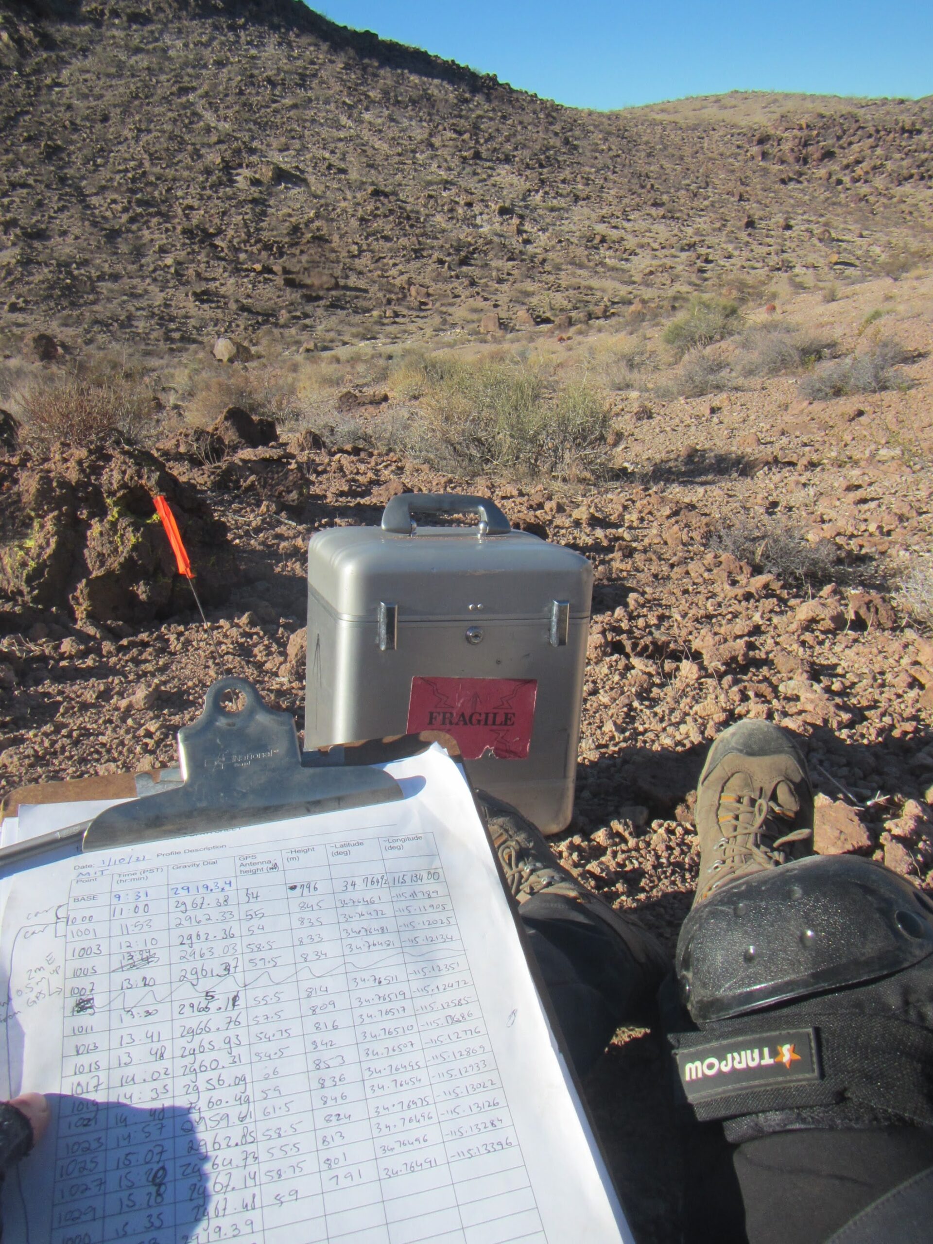
While a few participants are taking GPS and gravity measurements, a few others move past them.
Lunch of a GPS antenna (Prof. Herring was not supposed to see this, but it is clearly too late now…)
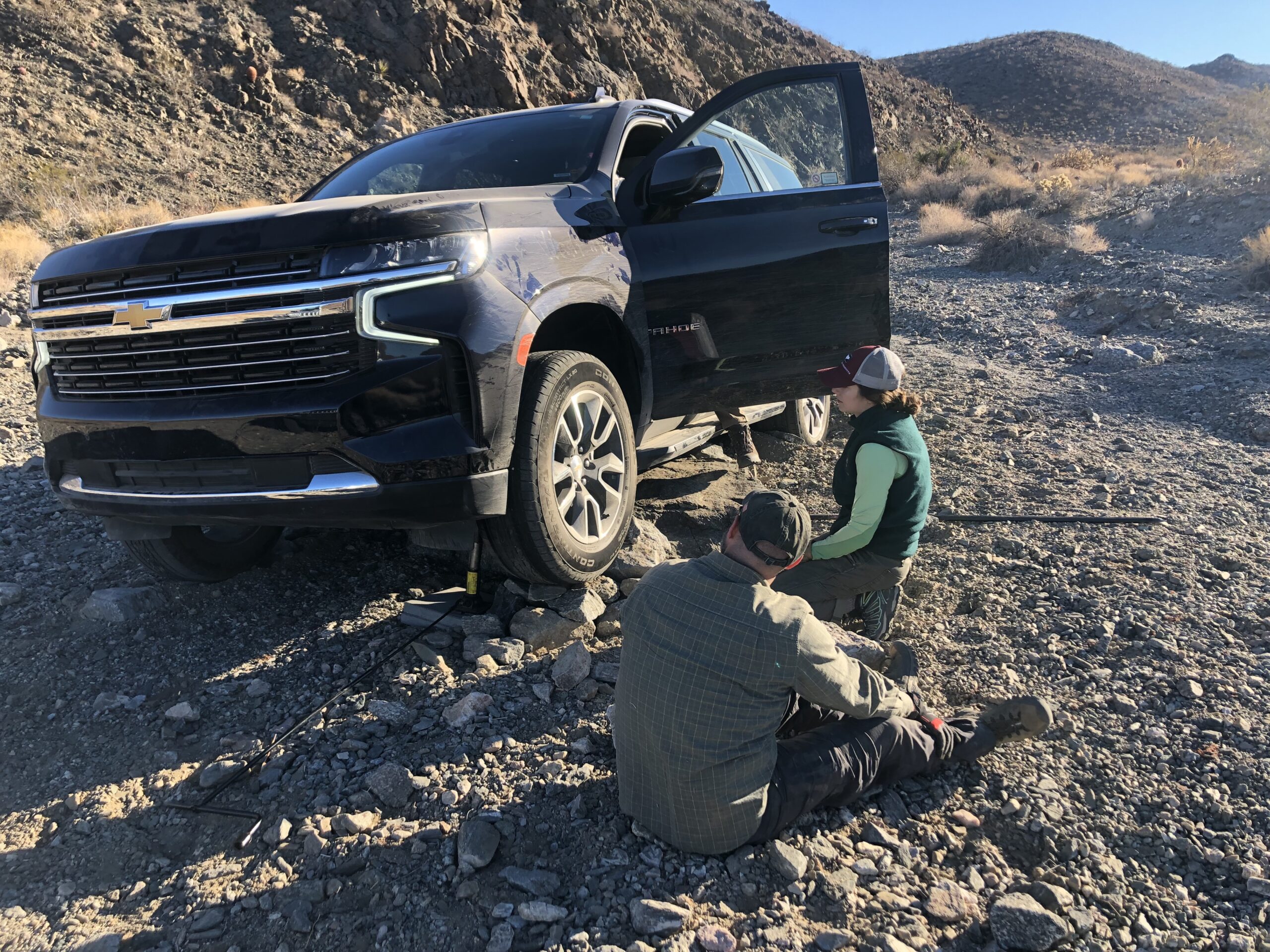
Professor Brent Minchew and Joanna Millstein trying to solve a new, unrelated geophysics problem: how to jack a Tahoe off a bedrock outcrop. The information on who put the car there in the first place cannot be disclosed. |
Ekaterina Bolotskaya PhD candidate, geophysics TA and seasoned IAP participant Several things made this trip very special. It was the first geophysics field trip since the beginning of the pandemic, the first ever experience of taking geophysical measurements in the field for many of the participating students, and for a few, their first camping experience. I believe that doing fieldwork is a very important aspect of being a geophysicist: knowing how the data is collected and understanding the limitations of the process helps a scientist be mindful of that during the data processing and problem solving stages. It was very exciting to be there with the students during their first field experience, help them explore the geophysical data acquisition methods and learn together with them. This trip was also the first time that we shared the survey location with a group of geology students from our department, led by Associate Professor of geology Oliver Jagoutz. They had been to the same field site several times and had a good idea of the geology of the area, asking questions that they could not answer with just surface observations and needed our geophysical methods. We chose one of the more interesting questions: determining the dip angle and direction of a fault in the area, which can be constrained with precise measurements of quantities like gravity, topography, and seismicity. We geared up with geophysical equipment and left cold Boston for Las Vegas and then Piute Mountains. It is hard to beat venturing out into the wilderness with a geologic map and applying the classroom knowledge in the field by planning the best survey layout, choosing the methods to tackle the problem and acquiring real data. On this trip, we did several gravity surveys. This method is capable of detecting underground density anomalies and is a perfect fit for our question of determining the fault dip because it allows us to infer models for the subterranean density structure, which provide constraints on the fault dip. We also deployed an array of passive seismometers across the fault to collect seismic data and do ambient noise tomography. This method allows us to further constrain the rock types down to 2 km below the surface, thereby providing unique information that complements the gravity measurements. Precise GPS measurements accompanied the gravity and seismic surveys. It was the first time in the history of MIT geophysics field trips that we used drones to get high-resolution topographic maps of the area under the supervision of Daniel Sheehan, a Senior GIS Specialist at MIT Libraries, and Joanna Millstein, a graduate student and a licensed drone pilot. Everyone in the group got a chance to make different types of geophysical measurements and collect the data that will be used to determine the fault dip angle and direction. Overall, it was one of the best field trips I have ever been to: we all learned new geophysical data acquisition techniques, got a taste of what it is like to do field work, bonded with each other, and had a great time! The data we collected together with the prior information we obtained from the geologists will help us determine the dip angle and direction of the fault of interest. The students will be processing the data over the Spring Term under the supervision of Professors William Frank and Cecil and Ida Green Professor of Earth Sciences Bradford Hager. Stay tuned; I’m excited to see the results! |
|
|
|

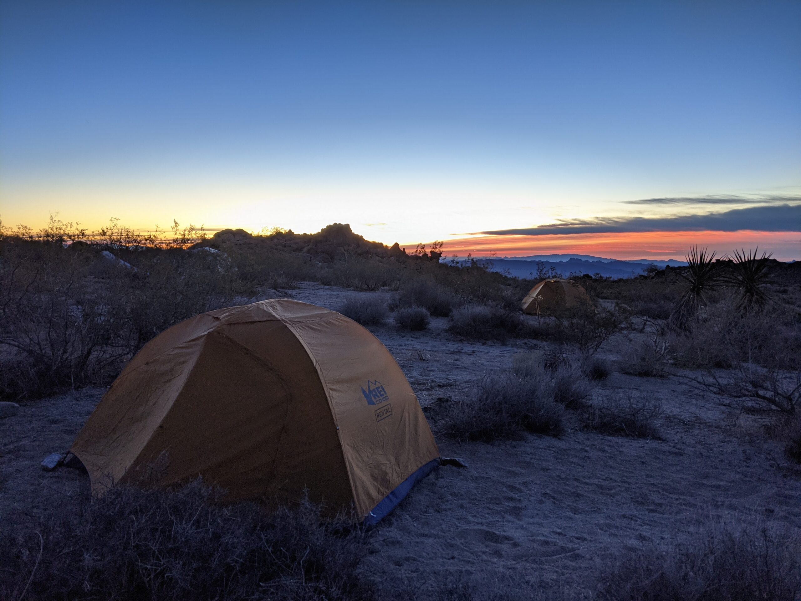
Sunrise in the desert across the bushes, the first thing you see in the morning from your tent.
Perfect example of folds on folds during our geology session.
Rock and bones cairn to show the way. During measurement, an opener would go ahead and mark points for gravity measures. To avoid getting lost we had to be creative.
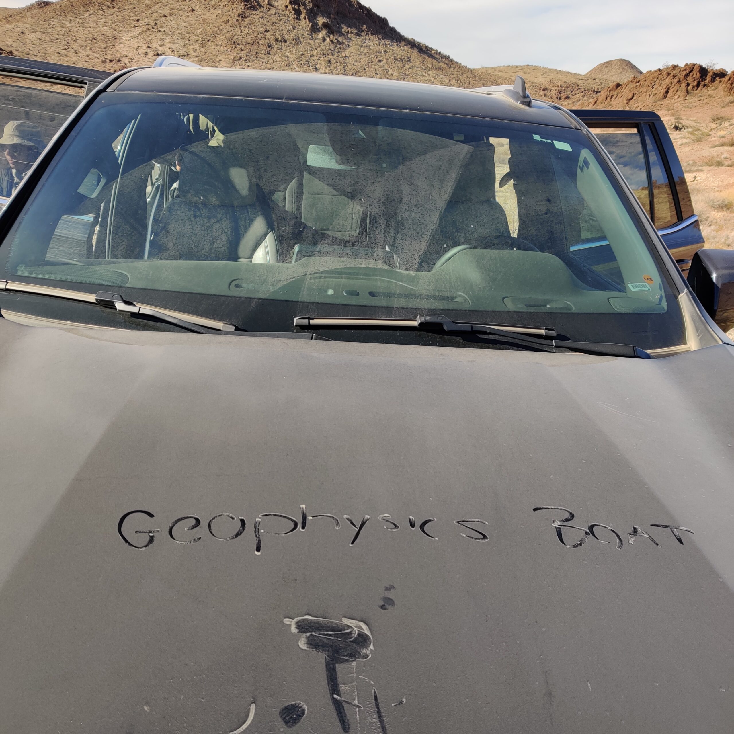
Geophysics Boat is the surname of the biggest car at camp that drove like a boat in the wilderness. |
Mathilde Wimez PhD Student, geophysics lab and first-time participant I decided to go to the field this year because I missed a lot of opportunities during COVID, and the Mojave Desert sounded like the perfect place to spend a week of January to forget about the snowy days of Boston. The goal of the trip was to help answer geological questions. The area we studied is a very complex place made of rock created from various marine deposits that have been folded and broken up by faulting throughout millions of years. Using geophysics data like seismology and gravimetry, we can make a transect, or a line through the rock, to observe the geometry of the layers in-depth, allowing us to study the complexity of the geology. During the trip, my favorite activity was flying a drone! It was very fun and required a lot of attention and techniques. But it was probably at the same level of fun as playing soccer against the geologists 😉 I learned a lot about improvising and adapting in the field. Not everything goes as planned- sometimes you have to unstick a huge car from sand, remove a cactus from a friend’s bottom, find another spot to dig a hole for the seismometer, carry a heavy suitcase with very expensive materials to the top of a mountain and so on… I would highly recommend participating in the field trip. It was a very fun and instructive time. It is the best place to learn how geophysical measurements are taken, how they work and how other scientists answer problems! The perfect combination of science and fun always awaits anyone going out in the field!
Mathilde Wimez and Lucy Sandoe riding the back of the truck after the geophysics boat got stuck in the sand. Another need to be creative on the field. |
|
|
|
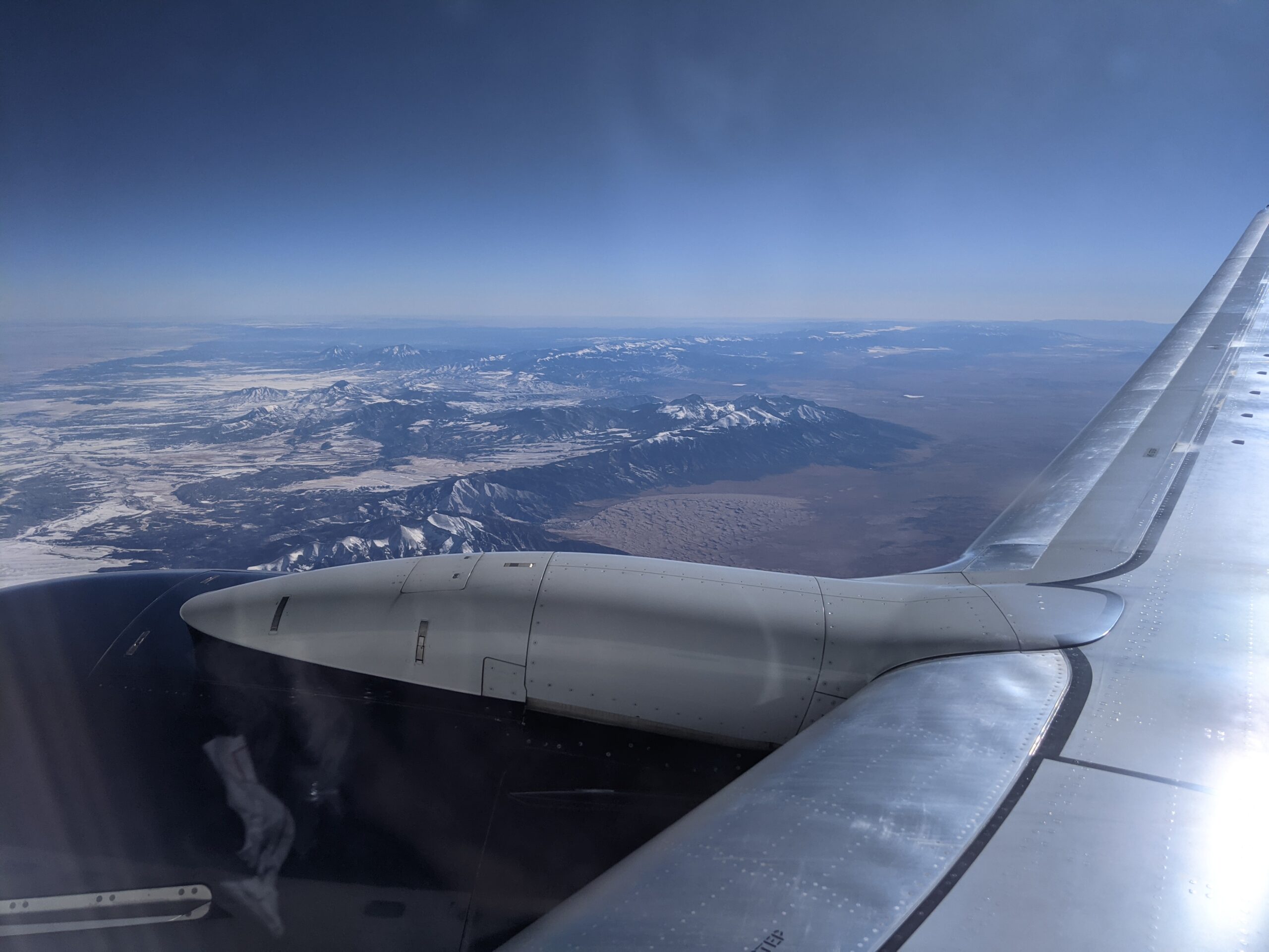
We were flying from the east to the west, entering the basin and range region with enormous deserts and mountain ranges.
Hilary Chang taking gravity and GPS measurements at a station.
Although Professor William Frank’s blue penguin was too heavy for the done, she sat happily on it and imagined herself flying!
Morning in the desert was chilly but beautiful. |
Hilary Chang PhD candidate, geophysics lab and first-time participant Our IAP geophysics field trip took place at the Piute Mountain in the Mojave Desert. The goal of our trip was to gain evidence of the location of a fault. This region has gone through several stages of compressions and extensions and has been left with largely overturned geological formations. Every day, we walked the rough terrain to collect gravity and GPS measurements. We also installed seismometers across the hills to collect seismic ambient noise, as the train traffic nearby provides abundant surface wave energy. We learned how to incorporate different survey methods to provide evidence for a geological problem, and how to conduct the surveys in a practical way, for example, using pacing to measure distances. The most fun part was using a drone to collect landscape images. Landing the drone safely in the desert wind really takes some experiences! During the one-week field trip, we cooperated with our geology team. In the evening at the field camp, we talked about our findings of the day and had fun cooking and playing soccer together. My favorite part of the trip, beside camping and digging holes for the seismometers, was to feel the numbers we collected. It was amazing to see how the gravity measurements changes after we just climbed a hill! It is even more amazing that we can derive the density of the hill beneath our feet after correction. We are excited to gain more information from these data after more detailed analysis.
Professor Oliver Jagoutz introduced local geological formations that helps us interpret our geophysics data. |


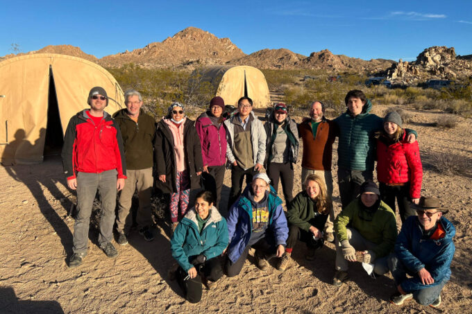
Story Image: Everyone who participated in the 2022 geology and geophysics IAP is very clean and energetic after a week of camping. Photo credit: Craig Martin