Pioneer in high-precision geodetic analytical methods and applications for satellite-based navigation systems to study Earth's surface.
Research Interests
My focus is the application of high precision geodetic measurement systems (millimeter accuracy)—primarily the Global Position System (GPS), Very Long Baseline Interferometry (VLBI), and Synthetic Aperture Radar (InSAR)—with the goal of improving the geodetic measurements to allow a wider scope of geophysical problems to be addressed. These applications include transient deformation and post-seismic motions after large earthquakes in California and other regions around the world; analysis of changes in the rotation of the Earth, and the positioning of moving platforms; and studies of the responses of very tall buildings (>350 meters high) to thermal and wind stresses.
I also develop data processing methods and data analysis from global and regional networks of GPS and other satellite navigation systems (GNSS), including investigating the accuracy of low-cost, multi-frequency, multi-GNSS systems (~$700 per unit) and testing whether they can replace the expensive (>$20K) systems currently deployed around the world.
Topics I investigate:
- Non-steady deformation processes in the Earth related to stress buildup associated with earthquakes and fluid movement.
- Data processing methods for extraction of signals for GNSS data.
- Assessing the impact of atmospheric conditions on GNSS positioning.
Biographic Sketch
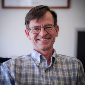
Tom Herring joined the EAPS faculty in 1989. After earning bachelor’s and master’s degrees in surveying from the University of Queensland, Herring completed his PhD studies in Earth and Planetary Sciences at MIT in 1983. He spent six years as a research scientist at Harvard University before returning to MIT as a professor of geophysics. Herring is a leader in the field of geodesy, having written several books and served on numerous committees for international standards, including several NASA advisory panels. He is a Fellow of the American Geophysical Union, the International Association of Geodesy, the American Association for the Advancement of Science, and the European Geosciences Union.
Key Awards & Honors
- 2013 • Fellow, American Association for the Advancement of Science
- 2007 • Vening-Meinesz Medal, European Geophysical Union
- 1995 • Bomford Prize, International Association of Geodesy
- 1991 • Macelwane Medal, American Geophysical Union
Key Publications
-
Herring, T. A., J. L. Davis, and I. I. Shapiro, (1990) Geodesy by radio interferometry: The application of Kalman filtering to the analysis of VLBI data, J. Geophys. Res., 95, 12561–12581. doi: 10.1029/JB095iB08p12561
-
Herring, T.A., T. I. Melbourne, M. H. Murray, M. A. Floyd, W. M. Szeliga, R. W. King, D. A. Phillips, C. M. Puskas, M. Santillan, and L. Wang, (2016) Plate Boundary Observatory and Related Networks: GPS Data Analysis Methods and Geodetic Products, Rev. Geophys., 54, doi: 10.1002/2016RG000529.
-
Herring, T. C. Gu, M. N. Toksöz, J. Parol, A. Al-Enezi, F. Al-Jeri, J. Al-Qazweeni, H. Kamal, O. Büyüköztürk, (2018) GPS measured response of a tall building due to a distant Mw 7.3 earthquake, Seis. Res. Lett, 90(1), 149:159. doi: 10.1785/0220180147

